


We need rain, but not the Flooding
Wet Start to work week

An area of disturbed weather offshore the SE U.S. Coast, will drag moisture over South Florida. It has the potential for Heavy Rain starting Monday afternoon and sticking around thru Tuesday.
The local NWSMiami office suggests some storms could drop 1-2” of rain, with some amounts as high as 3-5”. A worst case scenario has 5-7” of accumulation over the Broward & Miami-Dade metropolitan areas.
FLOOD WATCH

A Flood Watch will go into effect Monday afternoon until 11 pm, for the potential of standing water, specially in low-lying areas. This watch could be amended further if rain totals start to increase more than forecast.
WHAY ALL THE RAIN?
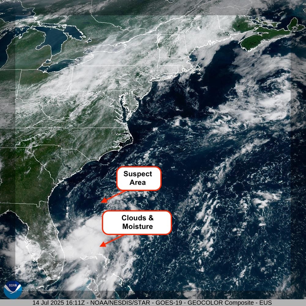
There is a suspect area of clouds and rain offshore the SE Coast. It is now a low pressure system. The northern half of the low is exposed to the elements, while all the clouds and rain sit to the south.
As the low spins counterclockwise, it will draw moisture from the Gulf Waters & the Caribbean over South Florida. This in turn will lead to the potential for heavy downpours.
NHC WATCHES THE LOW
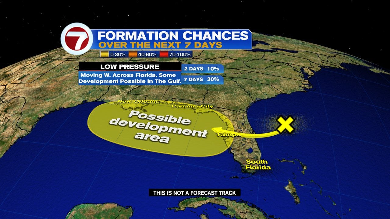
The National Hurricane Center (NHC), is watching the low as it moves westward into the Gulf waters over the next few days. NHC is giving the low at 10% chance to develop somewhere inside the yellow area over 2 days, and a 30% probability over 7 days.
A Hurricane Hunter mission is set for Tuesday if needed.
The Worry Meter for a direct tropical impact on South Florida is extremely low. Most early model runs keep whatever develops, near the Coast of the Gulf States.
Even if nothing comes out of this feature, there will be enough lingering moisture around to drop plenty of Rain across the Southeast, and keep us on the wet side as well.
Lets hope for the best that nothing materializes from this low.